
Northern Yellow-faced Turtle -- Emydura tanybaraga
[2]
Distribution
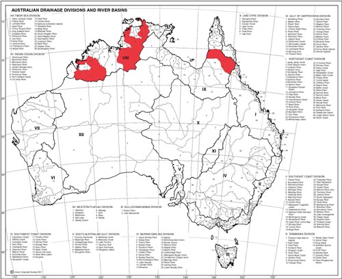
According to Cann (1998), Emydura tanybaraga
inhabits the following rivers and their tributaries: the Daly River, Finnis
River, South Alligator River, McKinley River in Northern Territory and Mitchell
River, Walsh River in Queensland. Cann does not mention any occurrence of
the species in the Fitzroy River and Isdell River basins in Western Australia,
but Thomson (2005, pers. comm.) found specimens of E. tanybaraga
within these basins. It is probable that further research will result in
assigning this species to other river basins narrowing the gaps between
the distribution areas of the three populations and extending the species
distribution up the Cape York Peninsula.
Right photo: Distribution map of Emydura tanybaraga
Natural habitat
E. tanybaraga occupies permanent water bodies
including rivers, lagoons, swamps and billabongs. The habitat occupied by
all three populations of E. tanybaraga is very similar but is described
here separately.
The Mitchell River basin (Queensland)
The climate in this region is tropical and monsoonal. More than 90% of the rainfall occurs from November to April. Mean annual rainfall varies from 800 mm to 2000 mm across the catchment. The watershed contains different habitats ranging from tropical rainforest, wet forest, a variety of woodland types, savanna, as well as extensive wetlands, estuaries, and mangroves.
Water quality: pH range: 6.5 - 7.7, 22 - 30°C.
Bottom photograph: The Oolloo Crossing, the Daly River, N.T.
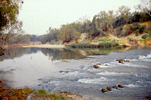 The Daly River and South Alligator River basins (Northern
Territory)
The Daly River and South Alligator River basins (Northern
Territory)
The upper region of Northern Territory has a monsoon-like climate. Virtually the entire rainfall occurs in the wet season, which varies in length but is generally confined to the November-March period; October and April tend to be transitional months - with the dry season lasting from about May to September. Annual rainfall averages approximately 1900 mm. Prevailing winds are easterly to southeasterly in the dry season and northerly to north-westerly in the wet season, and like other parts of northern Australia, the region is subject to cyclones.
Water quality: pH range: 6.5 - 8.0, 24 - 32°C.
The Fitzroy River basin (Western Australia)
The climate is tropical. Average annual rainfall varies considerably in the basin, ranging from 375 mm in the south to 900 mm in the north. The Fitzroy River is the major river system in the basin with a vast alluvial floodplain and extensively braided river channels. Flows occur between November and May following rainfall associated with tropical lows, monsoonal depressions and summer thunderstorms moving inland from the north.
Water quality: pH range: 6.5 - 8.0, 22 - 28°C.